 |  |
| (Station Photograph - click to enlarge) | (Sensor Layout - click to see PDF File) |
| CESMD |
| Information for Strong-Motion Station |
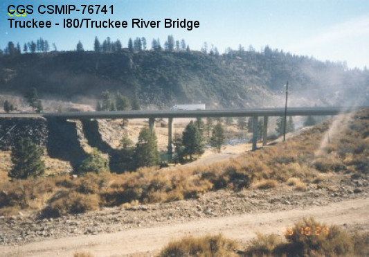
| Truckee - I80/Truckee River Bridge |
| CGS - CSMIP Station 76741 |
| Earthquakes recorded by this station |
| |
| (Station Photograph - click to enlarge) | (Sensor Layout - click to see PDF File) |
| Latitude | 39.3680 N |
| Longitude | 120.1151 W |
| Elevation (m) | 1696 |
| Site Geology | N.Abut: Fill; FF: Rock |
| Vs30 (m/sec) | 469 (inferred) |
| Site Class | C |
| Remarks/Notes | Site information sources |
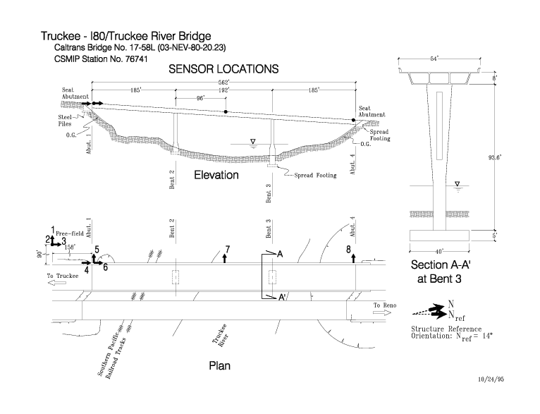
| No. of Spans | 3 |
| Plan Shape | Straight. |
| Total Length | 562' (171.3m). Bridge spans are 185' (56.4m), 192' (58.5m), and 185' (56.4m). |
| Width of Deck | 54' (16.5m) |
| Construction Date | 1989 |
| Instrumentation | 1995. 5 accelerometers on the bridge. 3 accelerometers at a free-field site. |
| Superstructure Type | Continuous concrete box girder. Open end seat abutments with elastomeric bearings and exterior shear keys. |
| Substructure Type | Concrete columns with I-shaped cross-section in the upper portion and rectangular below. 1 column per bent. |
| Foundation Type | Columns and 1 abutments are supported by spread footings. The other abutment is supported on steel piles. |
| Remarks | This bridge was instrumented under the interagency agreement between Caltrans and DOC. |