 |  |
| (Station Photograph - click to enlarge) | (Sensor Layout - click to see PDF File) |
| CESMD |
| Information for Strong-Motion Station |
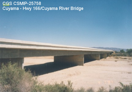
| Cuyama - Hwy 166/Cuyama River Bridge |
| CGS - CSMIP Station 25758 |
| Earthquakes recorded by this station |
| |
| (Station Photograph - click to enlarge) | (Sensor Layout - click to see PDF File) |
| Latitude | 34.9331 N |
| Longitude | 119.5941 W |
| Elevation (m) | 694 |
| Site Geology | |
| Vs30 (m/sec) | |
| Site Class |
| No. of Spans | 7 |
| Plan Shape | Curved with skew. |
| Total Length | 560' (170.7m). Bridge spans range from 65' (19.8m) to 86' (26.2m). |
| Width of Deck | 39.5' (12.0m) |
| Construction Date | 1980 |
| Instrumentation | 1997. 9 accelerometers on the bridge. 3 accelerometers at a free-field site. |
| Superstructure Type | 4-cell concrete box girder with 1 intermediate hinge. Diaphragm abutments. |
| Substructure Type | 15" thick concrete pier walls. |
| Foundation Type | Steel H-piles support abutments and piers. |
| Remarks | This bridge was instrumented under an interagency agreement between Caltrans and DOC. |