 |  |
| (Station Photograph - click to enlarge) | (Sensor Layout - click to see PDF File) |
| CESMD |
| Information for Strong-Motion Station |
| Gilroy - 2-story Commercial Bldg [Abandoned] |
| CGS - CSMIP Station 57476 |
| Earthquakes recorded by this station |
| |
| (Station Photograph - click to enlarge) | (Sensor Layout - click to see PDF File) |
| Latitude | 37.0090 N |
| Longitude | 121.5690 W |
| Elevation (m) | 60 |
| Site Geology | Deep alluvium |
| Vs30 (m/sec) | 309 (inferred) |
| Site Class | D |
| Remarks/Notes | Site information sources |
| No. of Stories above/below ground | 2/0 |
| Plan Shape | Rectangular |
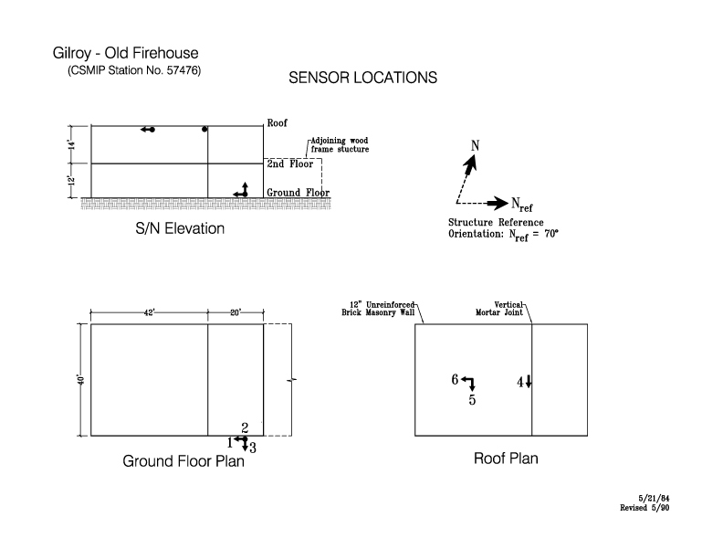
| Base Dimensions | 62' x 40' |
| Typical Floor Dimensions | 62' x 40' |
| Design Date | pre-1916. |
| Instrumentation | 1984. 6 accelerometers, on 2 levels in the building. |
| Vertical Load Carrying System | Wood frame diaphragms (beams, joists and sheathing) supported by columns and unreinforced brick masonry (URM) walls with good quality lime mortar. 2nd floor diaphragm: Diagonal sheathing. Roof diaphragm: Straight sheathing. |
| Lateral Force Resisting System | Longitundinal direction: Perimeter URM walls. Transverse direction: Interior (one) and perimeter URM walls. |
| Foundation Type | Continuous concrete spread footings under walls. |
| Remarks | This is one of several buildings in Gilroy designated as Historical. |